

Explore
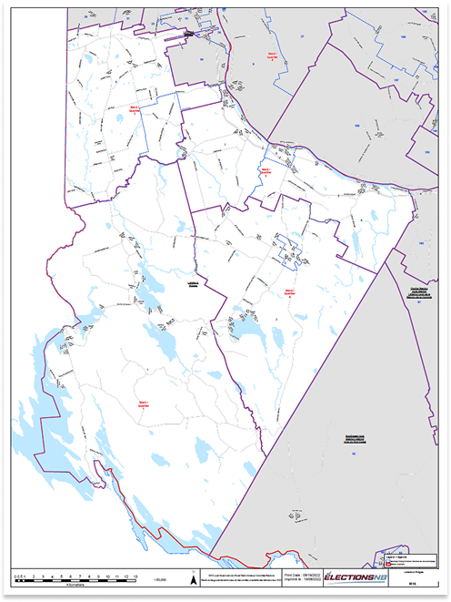
Lakeland Ridges Municipality Map
The Lakeland Ridges Municipality Map provides a comprehensive overview of the region, highlighting key landmarks, neighborhoods, natural features, and essential services. Designed for residents, visitors, and businesses, the map serves as a vital resource for navigation, planning, and exploring the community’s unique offerings.
About Lakeland Ridges
The Municipality of Lakeland Ridges was established on January 1, 2023. It was formed following the launch of Local Governance Reform by the Department of Environment and Local Government in 2021 and as the result of a transition and restructuring process held during 2022. This process merged the former villages of Canterbury and Meductic with the Local Service Districts of North Lake, Debec (inside and out), Benton, Canterbury, and a portion of lower Woodstock. As of the 2021 Census it has an estimated population of 2,450. Lakeland Ridges is located in Western New Brunswick and is bound by the U.S. border to the west and the beautiful Saint John (Wolastoq) River to the east. It is less than an hour away from our Provincial Capital, Fredericton.
Location within New Brunswick
Coordinates: 45°52′21″N 67°27′50″W
Country : Canada
Province: New Brunswick
County: York
Regional service commission: Western Valley
History
Infrastracture
Education
Lakeland Ridges offers a unique blend of natural beauty and outdoor activities. This makes it an ideal destination for adventure seekers and nature lovers. Lakeland Ridges truly is a welcoming community
Where Nature Thrives and Adventure Awaits.
Lakeland Ridges is composed of four different wards. Each ward offers its own uniqueness in
beauty, lifestyles, and opportunities and provides a variety of experiences for both locals and
tourists. With its picturesque views, hiking and recreational trails and fishing spots it is a must-
visit destination. It is a very desirable place to live, work, vacation and retire!
Ward One
Encompasses the communities of North Lake, Fosterville, Forest City, Green Mountain, Pemberton Ridge, and Maxwell. It also includes East Grand Lake, First and Second Eel Lakes, and Spendic Lake. Public Boat Launches are available at East Grand and Spendic Lake. A public Boat Wash Station is located at the North Lake Fire Station along Route 122. North Lake Provincial Park is located within ward one and here you will find camping (an off-grid gem offering 45 camp sites), a nice sandy public beach (unsupervised) and a beautiful lake for canoeing, kayaking, and fishing.
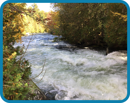
It should be noted that North Lake is the headwaters to the St. Croix giving adventure seekers the opportunity to multi-day paddle from the park, down the St. Croix to the Passamaquoddy Bay. Hikers can experience a trip to Mud Lake Falls which may be accessed by the Spendic Boat Launch in Forest City. This area is also noted for its many winter recreational activities like snowmobiling and snow shoeing.
Ward Two
There are many well established communities in this area that host many local events and get togethers on a regular basis. Debec’s “Redneck Curling” is a favourite local event to drive away the winter blues. Just dig out your “Broom” of choice and sign up – the washer fluid jugs will be provided.
Ward Three
Ward Four
Places must visit
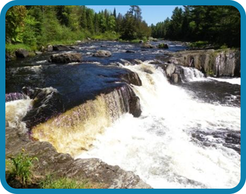
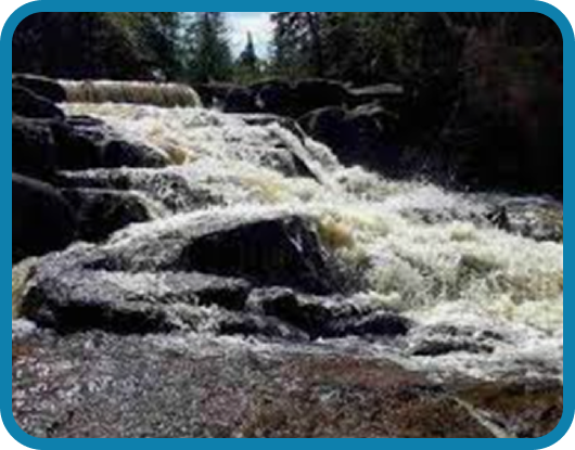
Eel River Falls Trail
Directions – From Route 2 take Route 122 to Canterbury. As you enter Canterbury, go past a graveyard, and turn onto Mill Street. Drive to the end of Mill Street and turn left onto Upper Skiff Lake Road. Turn right onto Scott Siding Road. Continue on this road until you come to a junction. Turn right onto Dickinson Road. You can access the NB Trail (the old railroad bed) on your right. Park somewhere along the road as there is a no trespassing sign at the farmhouse at the end of the road. Get on the trail and turn left. Travel for about 1.5 km. and you will come to a hydro line. On the
right you can almost see the river down in a small valley. Continue for about another 700 meters and turn right onto the first road. After a short distance turn right onto a second road. After about 200 meters you will find the trail down to the falls on the left. Eel River Falls are only 2 meters high but impressive to see because it cuts across the width of the river. Part of the shelf that creates the falls extends into two flat rocks at either end of the falls. These make great viewing platforms.
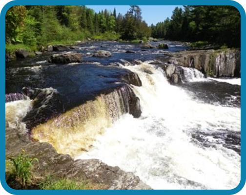
Hay Falls Maliseet Trail
From Woodstock (Connell Street – Route 550) take exit onto highway 2 heading east towards Fredericton. Drive 15 kilometres and take exit 200 and turn left onto Dugan Road. When you get to the bottom of the hill turn right onto Highway 165. Drive for another 2 kilometres and look for a long narrow parking area on the right. You should also see the signs for the trail.
The Maliseet trail was an ancient travel route (portage) for the Maliseet First Nations. The trail joined the Saint John River with the Penobscot River in Maine and was used up until the 1600s.

The trail connected through many lakes, rivers and streams and was comprised of over 200 km of paddling and less than 20 km of portaging. Today the Maliseet hiking trail is only a small portion of its former self and is mainly used to access Hays Falls. From the parking area the trail ascends through a mainly soft wood forest and transitions into a hardwood ridge. There is a picnic table in a cedar stand about halfway up the hill. At the top of the hill (about a kilometre) the trail comes to a junction. Going straight will take you out to the highway in a couple hundred metres. You will want to go to the right.
The right branch of the trail descends towards the falls. After a short distance the trail branches again. The trail to the right continues to descend to the bottom of the falls. The trail to the left ascends to the top of the falls. There is a picnic table at the top of the falls and a fence across the top for safety. This is one of the tallest waterfalls in the province at around 80 feet. The main trail goes down to the bottom of the falls. At the bottom of the hill, you will come to the stream below the falls. You will come around a rocky outcrop on the left and be looking up at the falls. The stream is shallow so make sure you check the falls out from all angles. Be careful though because the rocks are always wet and can be slippery.
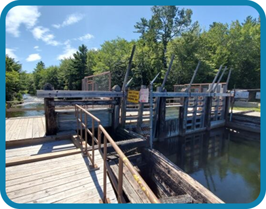
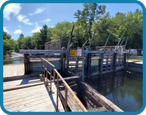
Forest City Dam
Dam Road, originally King Street, Forest City, NB
The tiny Forest City Dam is situated on the border of New Brunswick and Maine. In this picturesque area next to the Dam are a couple of clear spots with a few picnic tables scattered about, a campfire pit, chairs, a wooden swing and an outdoor toilet. A perfect spot for swimming, a cookout, picnic, fishing or just relaxing with friends.
Benton Boat Landing

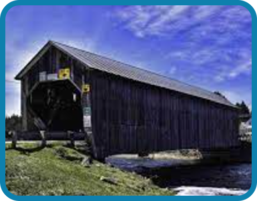
Benton Bridge - Eel River No. 3 Covered Bridge
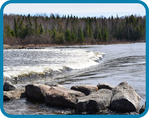
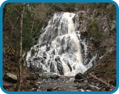
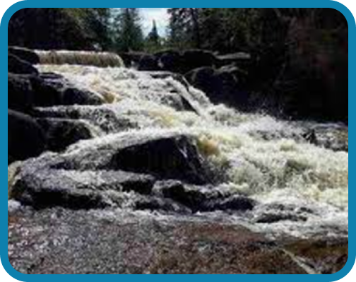
Mud Lake Falls
Mud Lake Falls is an overfalls. Experience this 1.1-km out-and-back trail near Forest City, New Brunswick. Generally considered an easy route, it takes an average of 14 min to complete. Take Route 122, which takes you from Meductic to Canterbury and beyond. The trip through Canterbury and past the various lakes is scenic. Once you arrive at Fosterville, turn left onto Forest City Road. You will drive about 8 miles down the Forest City Road to Spendic Lake Road. Turn left onto this road, go about 1 mile and park. There is a road that you can drive on, however there is no parking space along the road and other people are using this road for
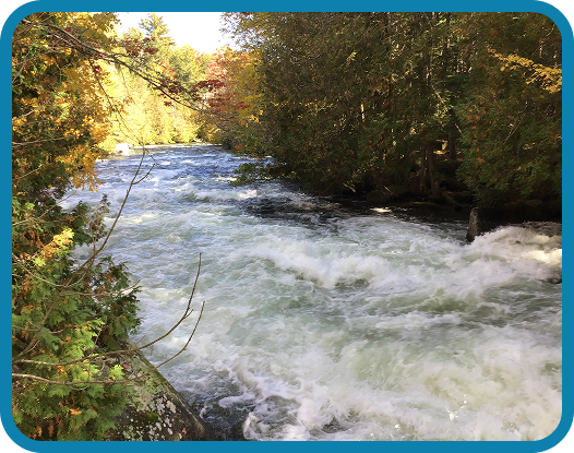
camp access. The walk is easy and soon you will see a trail that takes you to the falls. The waterfalls are on the US-Canada border. Scattered about are picnic tables and there is a nice fire pit for your use.
Shogomoc Falls Trail
From the Esso Gas station at the Meductic Exit take Route 2 towards Fredericton. After 12.5 kilometers you will come to the bridge over the Shogomoc River. Park just before the guardrail on the Woodstock side of the river. Follow the guardrail towards the river and go down the hill next to the bridge. Just before you reach the river turn right and enter the woods. There are signs of an old road that follows along the river at the top of hill but is sometimes hard to follow. Just follow the river until you reach the waterfall at 600 meters. The powerlines cross the river just above the first falls.
A larger, more impressive waterfall can be found about 300 meters above the powerlines.
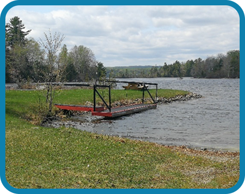
Forest City Public Boat Landing
Dam Road, Forest City, NB
A scenic little public area where you can put your boat in. An opportunity to also sit and relax while enjoying the view.

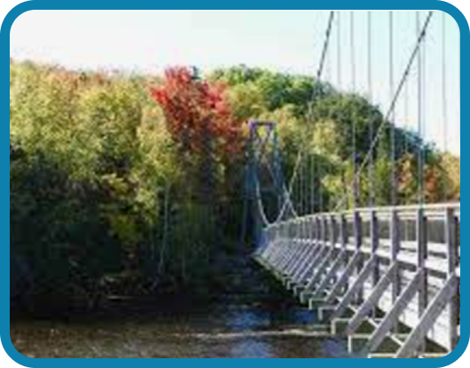
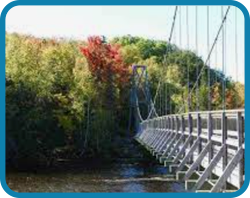
Shogomoc Suspension Bridge
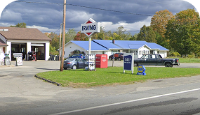
Restaurants
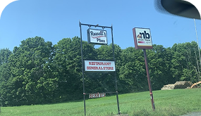
Russell’s Place Gas and Grocery, ANBL Agency Store
Cummings Bros & Son Gas and Grocery, Auto Repair Shop
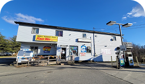
Debec General Store Gas and Grocery, ANBL Agency Store
Petro Canada Convenience and Lakeway Café
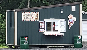
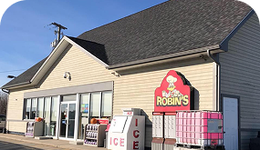
Buddy’s Place Ice Cream Shop
Harvest
House
Sanctuary
House
Historical Points of Interest
Mehtawtik (Meductic) Village National Historic Site
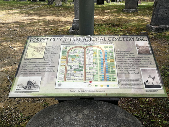
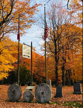
Forest City International Cemetery
1554 Forest City Rd
Forest
City, New Brunswick, E6H 1Z4 Canada
At one time, both Forest City, NB and Forest City, Maine, had their own separate burial sites. Because the “two” communities were in reality, one community straddling the international boundary, it made sense to combine the two cemeteries. When this occurred is unknown, but likely in the late 1800’s or early 1900’s. At the entrance to the present-day cemetery is a monument consisting of three granite grinding wheels salvaged from the old Grist Mill set on a concrete base with a plaque reading “In memory of Dr. Lyman A. Lydic, 1978”. Flags of both countries fly overhead.
North Lake Provincial Park
3884 Route 122
North Lake Provincial Park is a paddlers paradise located within the Municipality of Lakeland Ridges. Here you will find large private campsites, public beach, and a beautiful lake for canoeing, kayaking, and fishing. North Lake is the headwaters to the St Croix giving adventurers the opportunity to multi day paddle from the park, down the St Croix to the Passamaquoddy Bay. The North Lake campground is an off-grid gem offering 45 camp sites with limited services. Each campsite has a picnic table, area for your tent or small trailer, fire ring, and a short walk to potable water and dry toilets. You will love getting back to nature and away from the stress and distractions of everyday life. North Lake Beach is right around the corner offering a day use area or just a short walk from your campsite. Here you will find a nice sandy beach where you can unwind and relax. Please note that swimming here will be at your own risk as a lifeguard will not be on duty.
Rates:
Low season rates in effect May 21-June 20 and September 3-22
High Season rates in effect May 17-20 and June 21-September 2
Call for reservation 506-894-2225 or mail us at parcsnbparks@gnb.ca
Description
Low Season
High Season
Meductic Memorial Park
Park Street, Meductic NB
Situated when first driving onto Main Street in the village, the Park is located on Park Street, Meductic. This Park area is right angled with the Eel River which flows into the Saint John River. This Park is equipped with benches, picnic tables, washrooms, Tennis, Basketball and Pickleball Courts and beautiful docks plus a boat launch. Regular Park hours are 7am- 11pm seasonally in the summer. No camping is preferred.
Canterbury Memorial Park and Basketball Courts
199 Main Street, Canterbury NB
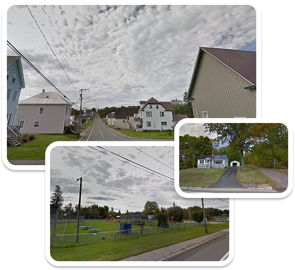
Situated in the Heart of Canterbury NB. This park features basketball courts, swings and children’s playground equipment and a skating rink.
Debec Recreational Park
404 Debec Road, Debec NB
In Debec NB. This area features a community centre and outdoor skating rink. Work is being done on a new children’s playground with hopes to have it completed this year. Providing services and programming for youth and seniors is of upmost importance for this recreational council.
North Lake / Fosterville Community Playground and Recreation Centre
4426 Route 122 Fosterville NB
Situated between area lakes and close to the Canada/US border crossing. This is where many community activities take place. On the grounds there is a basketball/pickle ball court, horseshoe pit, and children’s playground with swings, tetherball and climbing equipment. Inside our building is a library which operates on the honour system. Normal hours for the library are from 1:00 p.m. to 3:00 p.m. on Wednesdays, however anytime the building is open (except for private events) you may visit the library. Numerous
events for youth and seniors are held throughout the year in our community centre. It is also available for rent.
Benton Community Playground
Just across the Number 3 Covered Bridge, lining Eel River, this park features children’s playground equipment and picnic tables. There is easy access to the river for everyone to enjoy a cool down and a float down the river.